Tāmaki Ecological District Wetlands
Within the Tāmaki Ecological District there are a small number of freshwater wetlands that provide valuable habitat for wildlife in central Tāmaki Makaurau / Auckland.
Size: 46 hectares
Area description
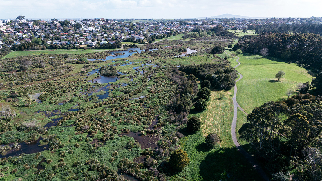
The Tāmaki Ecological District Wetlands biodiversity focus area includes over 20 mostly small but important wetlands scattered throughout the Tāmaki Ecological District.
An ecological district is a local part of New Zealand where the geology, topography, climate, plants and animals interrelate to produce a characteristic landscape and range of ecosystems.
The Tāmaki Ecological District includes the low-lying hills, pumice and other volcanic deposits of the North Shore, the Auckland isthmus as far south as Wiri on the edge of the Manukau Harbour and across to Cockle Bay on the Waitematā Harbour.
Some of the reserves the wetlands in this biodiversity focus area are in include:
- Waiatarua Reserve
- Onepoto Domain
- Chelsea Estate Heritage Park
- Anns Creek Reserve
- Coatesville Scenic Reserve
- Waikumete Cemetery.
Wetland ecosystems
The wetlands in this biodiversity focus area include examples of:
- raupō reedland (WL19)
- Machaerina sedgeland (WL11)
- flaxland (WL18)
- gumland (WL1.2).
The Auckland Protection Strategy, produced by the Department of Conservation in 2009, states that the original ecosystems found in the Tāmaki Ecological District included a network of freshwater wetlands and lakes formed by the blockage of drainage patterns by volcanic activity.
The report estimates that only one percent of the historic extent of freshwater wetlands remain in the Tāmaki Ecological District. The wetlands within this biodiversity focus area are therefore of high biodiversity value.
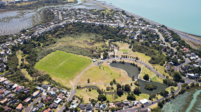
Waiatarua Reserve
One of the larger wetlands in this biodiversity focus area is within Waiatarua Reserve. The wetland was originally a tributary of the Tāmaki River which was sealed off by a lava flow from the Maungarei / Mount Wellington eruption, resulting in the formation of a lake with swamp surrounding its margins.
In the late 1880s (and later), attempts to drain the lake and remove the swamp to establish parkland were not completely successful. In 1987, restoration plantings began for stormwater management and to create habitat for birds.
The wetland now provides habitat for many native birds including:
- mallard ducks
- pāpango (New Zealand scaup)
- kuruwhengi (Australasian shoveler)
- tētē moroiti (grey teal)
- poaka (pied stilt)
- matuku (white-faced heron)
- shag species
- kahu (harrier)
- pūkeko.
The network of wetlands within this biodiversity focus area provides important habitat for native wetland birds including resident species and those moving across the landscape.